_PNG.png)
Highway to Heaven: Manali to Leh, a Himalayan Adventure
- Sai Venkatesh Vemuri
- Jul 14, 2024
- 14 min read

Updated: Nov 12, 2024
Leh'd out plans don't work for Leh Road trip on bikes from Manali to Leh is not just a journey; it's a test of endurance and spirit. This adventure isn't for those seeking comfort. This journey promises an unforgettable experience that will leave you with stories to tell for a lifetime.

Table of Contents
This route, renowned for its stunning landscapes and high-altitude passes, offers a blend of adventure and beauty that attracts many travellers and bikers. As you traverse winding roads flanked by towering mountains, cross icy streams, and navigate rugged paths, every moment is filled with awe and exhilaration.
The Route
Our plan was to take a flight to Delhi, followed by a bus ride to Manali. From there, we hit the road on bikes, embarking on an exhilarating journey to Leh. Our route would take us through a series of breathtaking and challenging locations including Rothang, Sissu, Tandi, Keylong, Jispa, Zing Zing Bar, Baralacha La, Sarchu, Pang, and Taglang La.
Once in Leh, we planned to explore the city and then venture to Nubra Valley, passing through Khardung La, North Pullu, Khalsar, Hunder, and Diskit.

The Journey: Mandi to Leh
Mandi
Our bus, which was supposed to reach Manali for breakfast, only made it as far as Mandi due to heavy traffic. We finally arrived in Manali around lunchtime, almost six hours behind schedule. Despite the delay, we were treated to spectacular views of the mountains and the soothing sounds of the gushing Beas River, making the extended journey a bit more bearable.


Manali
Day - 1 | Elevation - 2050 m | Distance Covered - 0 km
Once we finally reached Manali, we didn't waste a moment. We headed straight to the rental agency to pick up our bikes. After gearing up and completing the necessary ride checks, we made our way to the nearest fuel station. There, we filled up our tanks and picked up extra petrol in cans, knowing that there would be only one more fuel station available on the way to Leh.


Rothang La
Day - 1 | Elevation - 3980 m | Distance Covered -36 km
Rohtang Pass, standing at an elevation of 3,980 meters (13,058 feet), connects Manali to Keylong and is open only half the year, from May to November. The newly constructed Atal Tunnel, stretching for 9 km under this pass, now makes crossing over it optional.

The ascent to the top of Rohtang Pass takes close to two hours, and you'll be greeted with amazing roads and spectacular views. This scenic and thrilling climb makes it a perfect start to the trip.

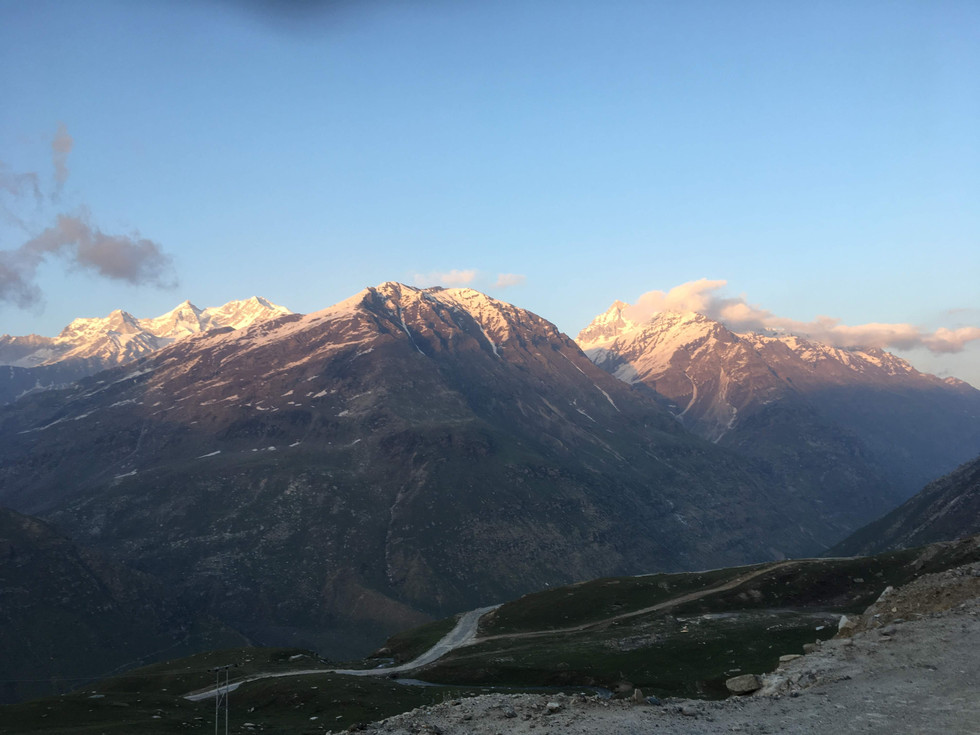
The weather at Rohtang Pass can be unpredictable, making it one of the most challenging roads in India. When we reached the top, we encountered dense fog and icy roads, with snow piled high on either side. Due to the high altitude and associated risks, it's not recommended to stay for an extended duration. We took a few quick photos before making our descent.


As sunset approached, we were treated to the sight of crimson peaks bathed in the warm glow of the fading sun. The road during our descent became more rugged, providing a taste of what lay ahead. This rough terrain is something that becomes increasingly common further along the entire route to Leh.


Sissu
Day - 1 | Elevation - 3120 m | Distance Covered - 70 km
A couple of hours from Rohtang Pass lies the town of Sissu. Unfortunately, we had to drive at night to reach there, which I strongly advise against. Navigating the rugged sections of the road is tough enough during the day, and the darkness only adds to the challenge, making it even more difficult. If possible, plan to reach your destination before sunset to avoid these unsafe conditions.
In Sissu, you can find plenty of stay and food options, making it an ideal place to halt for the night. The town offers breathtaking views of the mountains and the valley, with streams of water gushing down the mountain slopes to join the Chenab River below. I definitely recommend stopping here to rest and soak in the nature before continuing your journey.


Tandi
Day - 2 | Elevation - NA | Distance Covered - 96 km
The fuel station in Tandi is one of the last ones you'll encounter in Himachal Pradesh. After this point, the next fuel station is close to Leh. This is why you'll often see many bikers queuing up to fill their tanks here.

Tandi bridge is one of the significant landmarks present at the confluence of Bhaga and Chenab rivers. The bridge is constructed using steel and concrete to support heavy traffic, including military convoys and commercial vehicles.


Keylong
Day - 2 | Elevation - 3,080 m | Distance Covered - 105 km
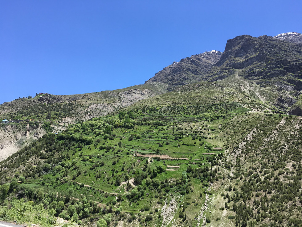
As you near Keylong, you'll begin to notice the distinct Buddhist influence permeating the region. This cultural shift is reflected in various aspects of the landscape and local life.


There are a few monasteries in this area, but due to time constraints, we couldn't make any stops. However, we did take a moment to admire the stunning views of the snow capped mountains and lush green valley.


Jispa
Day - 2 | Elevation - 3200 m | Distance Covered - 127 km
As we continued our journey, we reached the charming village of Jispa. Here, amidst the rugged terrain, numerous camp stays offer accommodation options. One of the highlights of Jispa is the direct access to the riverbed from the roadside. Naturally, we couldn't resist the urge to pause and immerse ourselves in the tranquil beauty of the surroundings. Sitting by the gently flowing stream, we played with the crystal-clear waters, letting the cool currents wash away the fatigue of the road.


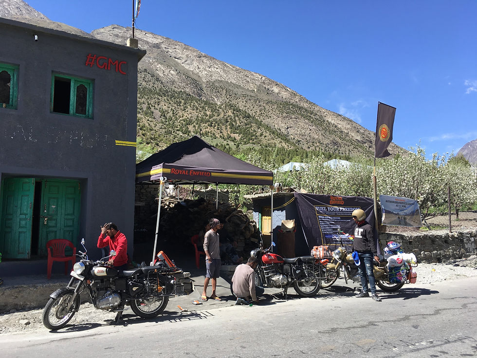
You'll also find a bike mechanic shop where you can get your bike's vitals checked and make any necessary repairs. It's a convenient stop for ensuring your bike is in top condition for the rest of your journey.
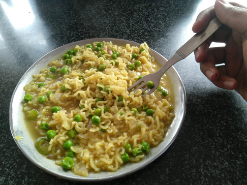
Except for a few long stretches, you'll find places to eat regularly along the route. Most of these stops inevitably serve tea, Maggi noodles, and dal chawal. Be mindful to order limited quantities and avoid wasting food, as supplies are delivered only once every few weeks. It's also a good idea to carry snack bars, chocolates, and other quick bites. And most importantly, don't forget to keep yourself hydrated!


Road trip to Leh tests your endurance more than anything. While you don't need to be a professional biker, considerable experience with heavy cc bikes is crucial. We embarked on our journey in the first week of June, shortly after the Border Roads Organisation (BRO) cleared the roads. However, I wouldn't recommend traveling this early. Mornings can be treacherous with patches of black ice, and by late afternoon, heavy water streams from melting snow make the ride exceptionally challenging.
Zing Zing Bar
Day - 2 | Elevation - 4270 m | Distance Covered - 157 km
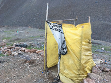
Our original plan was to reach the border town of Sarchu, but with the sun setting quickly and a challenging water stream blocking our path at Zing Zing Bar, we chose to turn back. In search of shelter, we found a simple tea-stall-cum-camp where we decided to stay.

The tent was very simple, equipped with a row of bedding and blankets to protect us from the cold weather. It had basic heating to help warm our hands and legs. The toilet consisted of a small open-air cubicle with a hole in the ground.


Baralacha La
Day - 3 | Elevation - 4850 m | Distance Covered -179 km
The next morning, we proceeded towards Baralacha La. We faced black ice, causing difficulties with maintaining balance and braking on the bikes. Despite the challenges, we managed to cross it.
Even though the landscape looks pleasant and calm, the weather in Leh is harsh and unpredictable. It's said that you can get frostbite on one hand while getting sunburned on the other. Be sure to carry loads of sunscreen (SPF 50+) and moisturizer. And don't forget the lip balm—traveling with cracked lips can be very irritating.
When it comes to clothing, you'll need gear that protects you from freezing temperatures. Dress in layers and choose a combination of winter wear that works best for you. Essential items include riding gloves, woolen socks, and waterproof boots for the wet sections.


Sarchu
Day - 3 | Elevation - 4201 m | Distance Covered - 212 km
Upon arriving at the border town of Sarchu, we encountered an issue with one of the bikes having a temporary registration, which prevented it from entering the neighboring state. Consequently, we had to leave the bikes at a nearby shop by the checkpost for retrieval later on. In order to proceed, we arranged for a car heading towards Leh from Sarchu.


Pang
Day - 3 | Elevation - 4700 m | Distance Covered - 288 km
This unexpected change in our plans gave us a chance to see the route from a different perspective and gave our sore asses a much-needed break. Riding in the car, we were able to relax and really take in the amazing scenery. The roads looked like they were from another planet, with barren landscapes and massive mountains casting huge shadows across the ground.


Taglang La
Day - 3 | Elevation - 5328 m | Distance Covered - 349 km
We reached Taglang La just as the sun was setting. This pass is one of the last high-altitude crossings before reaching Leh. The view from the top was incredible. It felt like a significant milestone, knowing that Leh was now within our reach.

Exploring Leh
Day - 4 | Elevation - 3500 m | Distance Covered - 457 km
Upon arriving in Leh, we crunched the numbers, factoring in the expenses of traveling to and from Sarchu, the overhead of renting new bikes in Leh, additional fuel costs, and concluded that it made economic sense for us to continue on to Srinagar from here and return from there. The rental agency agreed to retrieve the bikes from the Sarchu checkpost where we had left them.
Known for its breathtaking scenery, cultural richness, and lively traditions, Leh, the capital of Ladakh, captivates visitors with its narrow winding alleys, Buddhist-inspired architecture, and fluttering prayer flags. The bustling main bazaar is a vibrant center where you can discover incredible food, handicrafts, and much more.

Shey Palace
Shey Palace is majestically perched on a hilltop. The original palace, built in the 10th century, now lies in ruins at the hill's summit, serving as a historical marker of the region's ancient past. In the 17th century, a new palace and monastery were constructed just below the old structure. This newer palace once served as the royal residence for the kings of Ladakh. Although the royals no longer reside here, Shey Palace remains a significant cultural and historical landmark, drawing visitors who seek to explore its rich heritage and enjoy the breathtaking vistas it offers.

Surrounding the monastery at Shey Palace, you'll find an abundance of prayer bells and colorful prayer flags fluttering in the wind, adding to the serene and spiritual atmosphere. Inside the monastery, there is an impressive 12-meter tall statue of Shakyamuni Buddha in a seated position. This magnificent statue spans three stories high within the complex.


Thiksey Monastery
Thiksey Monastery is one of the largest and most architecturally impressive monasteries in Ladakh. Spanning 12 stories, the monastery cascades down a hill slope, creating a striking visual of whitewashed buildings and red accents. The complex includes courtyards, temples, prayer halls, and living quarters for monks. As you navigate the series of narrow staircases, each level reveals new layers of its rich heritage and culture. Climbing higher and higher, you're rewarded with stunning panoramic views of the valley.

The monastery is home to a magnificent 15-meter tall statue of Maitreya Buddha, a central figure that exudes serenity and grace. As you enter this sacred space, you can immediately sense the calmness in the air, amplified by the soothing chants of the monks that resonate throughout the room. The spiritual atmosphere envelops you, providing a deep sense of peace and tranquility. Simply sitting in the presence of the Maitreya Buddha and soaking in the serene environment offers a profound sense of solace.


Nubra Valley and Beyond
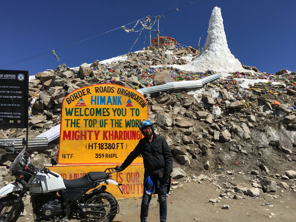
Khardung La
Day - 5 | Elevation - 5359 m | Distance Covered - 496 km
Khardung La, standing at an elevation of 5,359 meters, is one of the highest motorable passes in the world. Located approximately 40 kilometers from Leh, this iconic pass is a gateway to the Nubra and Shyok valleys.

Khardung La is definitely one of those passes every biker dreams of conquering. From the summit, you are treated to breathtaking views of the valleys below, with the rugged beauty of the Himalayas stretching out in every direction. The sense of accomplishment, combined with the stunning panorama, makes Khardung La a must-visit for any biking enthusiast.

At the very top of Khardung La, you'll find patches of snow and feel the bite of cold winds.. There's a small café where you can grab a warm drink or a bowl of Maggi. Due to the thin air, it's not advisable to stay for extended periods. After a quick photo-op, we began our descent, exhilarated by the experience of having conquered one of the world's highest motorable passes.


Acute Mountain Sickness (AMS) is a real thing. It's caused by lower oxygen levels at higher altitudes, and your body usually needs time to acclimatize.
While none of us faced serious issues, each of us experienced some discomfort at various points—nausea, headaches, and shortness of breath were the most common symptoms. To mitigate AMS, it's essential to take rest days, avoid exerting yourself too much, and acclimatize properly.


North Pullu
Day - 5 | Elevation - NA | Distance Covered - 511 km
North Pullu is a small village located immediately after descending from Khardung La. Visitors can get up close to the crystal-clear waters here. You may also spot various animals grazing peacefully amidst the rugged landscape. From hardy mountain goats to graceful yaks, these creatures add to the rustic charm.


Khalsar
Day - 5 | Elevation - 3264 m | Distance Covered - 551 km
Nestled along the banks of the Shyok River, Khalsar serves as a vital junction on the route to both Nubra Valley and the enchanting Pangong Lake.


Here, you can begin to notice the desert with its white sand, incredibly soft to the touch. We decided to take a short break before continuing our journey to Hunder, where we intended to spend the night.

The night sky in Nubra Valley is an experience that stays etched in memory forever. Here, amidst the serene beauty of the Himalayas, I gazed upon a sky ablaze with countless stars. Lying back, I found myself lost in wonder as I traced the path of the Milky Way stretching across the vast expanse above.
Hunder
Day - 6 | Elevation - 3048 m | Distance Covered - 583 km
Hunder is known for its mesmerizing sand dunes, creating a surreal desert-like ambiance against the backdrop of the majestic Himalayan peaks. These dunes attract many tourists for camel safaris, offering the opportunity to ride the unique Bactrian camels with their characteristic double hump.


Diskit
Day - 6 | Elevation - 3048 m | Distance Covered - 595 km
At the heart of Diskit lies the majestic Diskit Monastery, a symbol of spiritual tranquility that has graced the village for centuries. This ancient monastery, dating back to the 14th century, stands proudly atop a hill, offering panoramic views of the surrounding landscape.
One of the most awe-inspiring features of the monastery is its towering 32-meter tall statue of Buddha, completed in the year 2010. This magnificent statue, known as the Maitreya Buddha serves as a beacon of peace and enlightenment for all who visit the monastery.


An ATV ride in Nubra Valley provides the chance to conquer the majestic sand dunes of Nubra Valley. Here, you can feel the adrenaline surge as you tackle the dunes with speed and agility.

Agham
Day - 6 | Elevation - 3285 m | Distance Covered - 642 km
One of them recommended opting for the picturesque Agham route instead of Khardung La to reach Leh. This route covers around 130km compared to 90km via Khardung La and is not a common choice among tourists. Of particular concern is the lack of villages or human settlements along a 60km stretch between Agham and Sakti, which would pose a significant challenge later on.

You get to journey along one of the most beautiful roads, a lengthy narrow path flanked by mountains on both sides, devoid of any vegetation and stretching as far as the eye can see. It resembled a scene from the Looney Tunes cartoon The Road Runner.
There are two roads from Agham, one taking you to Pangong and the other leading towards Leh. Unfortunately, we didn't have enough time to visit Pangong Lake this time. But it's definitely at the top of our list for the next visit! You absolutely must make time for Pangong Lake during your trip.

Somewhere between Agham and Sakti
Day - 6 | Elevation - NA | Distance Covered - 680 km
The detour we decided to take was kind of a mixed bag. Those gravel roads slowed us down, but man, the views were something else—had to stop for pics! Then, as the sun dipped low and we hadn't seen civilization for last two hours, not having any phone signal started to freak us out a bit. Just when we were starting to worry, a spot a car heading our way—total lifesaver! They said the nearest village was still an hour off. So, we kept pushing through the dark and cold weather until we could see the village lights twinkling ahead. But wouldn't you know it, just when we were almost there, one of our bikes decided to act up—clutch cable snapped. If that had happened earlier, we'd have been screwed. But in the end, all the wrong things happened at the right time for us.


Phey
Day - 7 | Elevation - 3186 m | Distance Covered - 779 km
Indus & Zanskar River Sangam
The confluence of the Indus and Zanskar rivers, often called the Indus-Zanskar Sangam, is a geographical beauty. Here, the turquoise waters of the Zanskar River meet the mighty Indus, creating a stunning contrast of colors and currents.

Magnetic Hill
Another popular spot here is the Magnetic hill, where an optical illusion creates an impression that vehicles are pulled uphill, seemingly defying gravity.

"Anything that can go wrong will go wrong" ~ Murphy's Law.
Don't rely solely on calculations—if it's 100 km, you might think you'll reach in 2-3 hours, but that's rarely the case here. Numerous factors can extend your travel time: pit stops for food and bathroom breaks, mechanical issues with the bike, roadblocks due to maintenance work, and quick selfies that turn into long photoshoots.
We never reached a destination within the estimated time, forcing us to fast-track our visits. We had made a few reservations online, but we either missed them completely or partially, so I strongly suggest not making any reservations in advance. There are plenty of options available on the go.
Also, don't expect comfortable stays all along the route. Some locations only offer camps, where the restroom might be just a hole in the ground. To have a carefree experience, avoid extensive planning and just go with the flow.

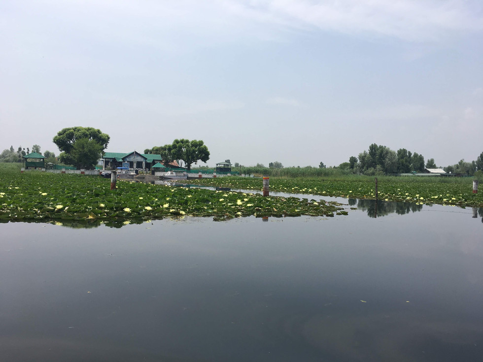
Srinagar
We arrived in Srinagar in the morning with just four hours to spare before our flight. After a quick freshen-up, we decided to take a boat ride on Dal Lake. We enjoyed the serene beauty of the floating markets and the stunning views of the surrounding mountains, making the most of our short time in this picturesque city.


Tips for Bike Travel
Bike rides expose you to the elements of nature, making the experience far more enjoyable but equally challenging.
The lack of mechanics for most of the journey is a key game-changer, so here are some tips to ensure a smoother ride:
When renting bikes in Manali, take a test drive for 3-4 km to check for any issues. Ensure you collect all necessary documents, permits, and toolkits.
Carry minimal luggage and secure it well using bungee ropes, balancing the load on both sides of the bike.
When crossing heavy water streams, avoid carrying a pillion rider.
When driving downhill, always stay in gear and avoid neutral.
You'll need to carry extra petrol in small cans or bottles, as fuel stations are scarce along the way.
Avoid driving on ice unless absolutely necessary. If you must, drive extremely slowly and avoid using the front brakes.
If you face any issues you can't fix on your own, reach out to fellow bikers. People are always ready to help.
For a worry-free journey on the road, it's advised to travel in a group equipped with a mechanic and a backup van.

And that wraps up this journey! Be sure to explore more stories on this blog. I'd love to hear from you, so feel free to connect through the contact section.
Essential Information
Who should visit?
Nature Lover
Culinary Enthusiast
Spiritual Seeker
Thrill Chaser
When to visit?
June to September, when most roads are clear of snow
Where to Stay?
Zostel at various locations
What to do?
Enjoy the roads
Don't over plan
Know your physical limits
How to travel?
Take a bus to Manali from Chandigarh or Delhi
Secure your bike rental in advance from Manali, ensuring to obtain the required permits beforehand
Recommended Trip Duration
9 Days / 8 Nights
Estimated Trip Budget
~INR 40,000 per Person*
*Excluding transportation to reach Manali


Comments